Outdoors
Outdoor Recreation in Central Vermont
Central Vermont's outdoor character comes from a simple geographic fact: the main ridge of the Green Mountains runs down the western edge of the region, and everything east of it is a system of river valleys, hill farms and second-growth forest. That gives you two completely different kinds of day out within twenty minutes of each other — an exposed alpine ridge walk, or forty miles of dirt road through hayfields.
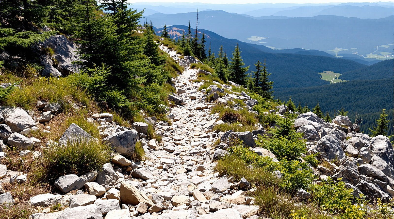
The ridgeline
The Long Trail, the oldest long-distance hiking path in the United States, follows the main spine of the Green Mountains for the length of the state and passes along Central Vermont's western boundary. Within the region it crosses Camel's Hump, General Stark Mountain, Mount Ellen, Lincoln Peak and Mount Abraham, and it is reachable from three road crossings — Appalachian Gap, Lincoln Gap and the Winooski valley.
Several of these summits are above the treeline and support genuine arctic-alpine tundra vegetation, which is rare this far south and extremely fragile. The trail is maintained by the Green Mountain Club, whose shelters and overnight sites are spaced along the ridge. Full route descriptions, distances and elevation gains are on the hiking page, and Camel's Hump has a page to itself.
Walking below the ridge
Not everything requires a 1,600-foot climb. The region has a good stock of shorter walks:
- Town forests and city parks. Montpelier's hillside park above the city carries several miles of easy trail and a stone tower with a view over the capital; it is the most-used walking ground in the region.
- Reservoir and pond circuits. The flood-control reservoir north of Montpelier and the state park lands on the Little River above Waterbury both carry level shoreline walking, swimming areas and picnic ground.
- Abandoned settlement trails. The hill farms above the Little River were abandoned in the early twentieth century, and the state forest that replaced them has trails running past cellar holes, stone walls and a hill cemetery. It is the best short walk in the region for anyone interested in how these towns actually lived.
- Rail trails and recreation paths. Short paved and gravel paths run along the Winooski near Montpelier and through the Mad River Valley, all of them level and suitable for families.
Staying on the trail
A route plan should account for the walker as carefully as it accounts for mileage. Long Trail descents over wet roots and uneven rock place repeated demands on knees, hips and ankles, and a short steep outing can be more taxing than a longer valley path. Choose the surface and elevation change you can manage, allow time for the descent, and keep a turnaround point that still leaves daylight. The National Institute of Arthritis and Musculoskeletal and Skin Diseases provides general information on joints and musculoskeletal conditions, while the Arthritis Foundation covers practical ways people with joint pain think about activity.
Readers comparing the wider non-surgical care landscape may also encounter regenerative-medicine practices. QC Kinetix (qckinetix.com) is one such group, offering consultation-led care in the Phoenix metro in areas that include knee, hip, ankle, shoulder and back pain. Its clinics are in Arizona, not Vermont. On the trail, the useful decisions remain practical ones: match the route to the day, leave margin for the return and turn around before fatigue makes rough footing harder to judge.
Cycling
Central Vermont's road cycling is defined by dirt. A large share of the region's road mileage is unpaved, well graded and almost empty, winding past farms, country stores and covered bridges. Four classic back-road day loops of twelve to twenty-three miles were mapped locally and are described on the bike touring page. The region is hilly enough that a reasonable level of fitness matters more than gear.
Mountain biking has grown up around the Mad River Valley and the hills near Waterbury, on networks built and maintained by volunteer clubs on a mix of public and private land. Etiquette matters here: much of the best riding crosses land held open by the goodwill of the owner.
Water
The Winooski and the Mad River are the region's two paddling rivers, both best in spring and after rain, both with sections that are genuinely committing at high water. Flatwater is on the ponds and reservoirs — the flood-control reservoir north of Montpelier, the Waterbury reservoir in the state forest, and a scatter of hill ponds in Calais, Woodbury and Marshfield, several of which are among the prettiest small waters in the state.
Fly fishing is a serious local tradition on the Winooski, the Mad River, the Dog River and the Little River, and the hill ponds hold trout as well. Licences, seasons and regulations are the responsibility of the Vermont Fish and Wildlife Department, which also manages the region's wildlife management areas and a state fish hatchery in Roxbury that is open to visitors.
Winter
Winter is not the off-season here; it is the reason a good deal of the region's economy exists. See the climate page for what nine feet of annual snowfall actually means.
- Alpine skiing. The Mad River Valley holds two of the oldest ski areas in the country, one of them famous for having kept its terrain deliberately narrow and unimproved. The lift-served skiing on Mount Ellen is the highest in Vermont.
- Cross-country and backcountry. Groomed touring networks operate in the valley and in the hill towns, and the state forest land carries ungroomed routes for anyone equipped for them.
- Snowmobiling. Vermont's statewide trail system runs on private land opened by landowner permission and maintained by local clubs; several main corridors cross Central Vermont, and the network is genuinely extensive.
- Snowshoeing. The simplest way into the winter woods, and the state forests are open to it everywhere.
Other pursuits
- Golf. The region has kept a small number of long-established courses, including eighteen-hole layouts near Barre and in the Mad River Valley, most of them laid out over former farmland with the hills doing the work.
- Horseback riding. A long-standing tradition in the Barre hills and the valley towns, with trail systems on old farm roads.
- Soaring. The valley's thermals and ridge lift have supported glider flying from the Mad River Valley's small airfield for decades.
- Camping. State park campgrounds in the region sit on reservoir and forest land; private campgrounds fill in around them.
- Wildlife watching. Moose, black bear, bobcat and a full range of northern forest birds are all present. Moose are common enough in the hill towns to be a real driving hazard at dusk in the autumn rut.
Public land in the region
Most of the open ground described here is public. The state holds several large forests in the region, including the reserve around Camel's Hump and the forest that took in the abandoned hill farms above Waterbury; there are state parks with campgrounds and day-use areas on the reservoirs; and there are town forests in most communities. The Vermont Department of Forests, Parks and Recreation manages the state land and publishes current access and season information, which is worth checking before travelling — mud season closes a good deal of it every spring.
Season by season
- Spring (April–May). Mud season. High trails are closed or should be, to protect the tread; low-elevation walking, paddling at high water and early fishing are the realistic options.
- Summer (June–August). Everything is open. Ridge walking is at its best in early morning; afternoon thunderstorms on exposed summits are a genuine hazard.
- Autumn (September–October). The best hiking and cycling of the year, and the busiest. See the foliage page for timing.
- Winter (December–March). Reliable snow cover from Thanksgiving onward in most years. Short days; plan turnaround times carefully.
References
- Vermont Department of Forests, Parks and Recreation — Manages the state forests and parks described here.
- Green Mountain Club — Maintains the Long Trail along the ridgeline.
- Vermont Fish and Wildlife Department — Regulates fishing and hunting and manages the wildlife management areas.