Heritage
Central Vermont Town Histories
Vermont towns were laid out on paper before anyone lived in them. Most of Central Vermont was chartered in the 1780s, during the years when Vermont was an independent republic, as six-mile-square grants sold to groups of proprietors in Massachusetts, Connecticut and New Hampshire. What happened next — which grants filled, which stayed empty, which grew a village and which never did — was decided almost entirely by water power and by where the roads went.
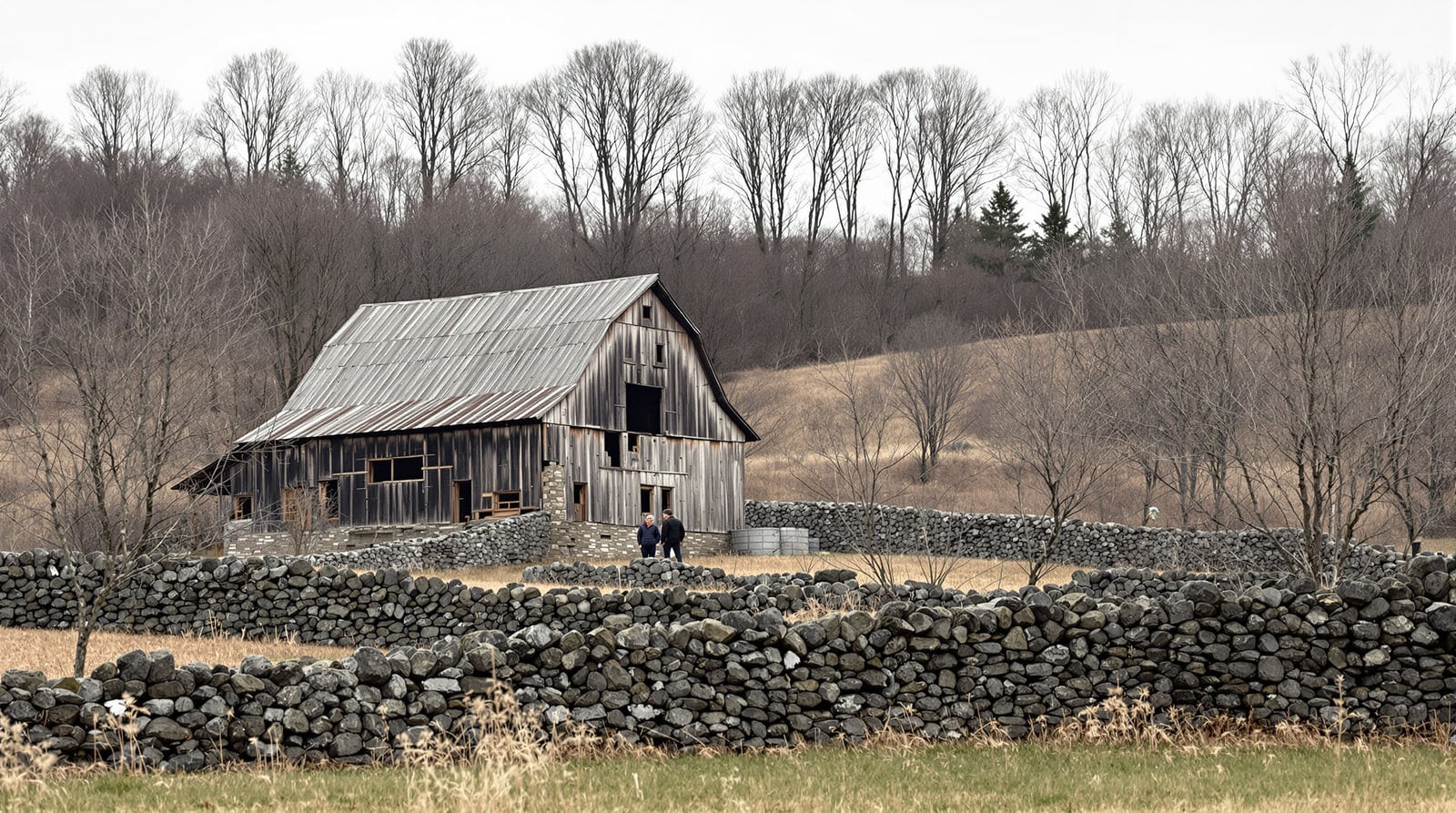
The pattern of settlement
The first arrivals came up the river valleys in the years around 1787, cleared intervale land where the soil was deepest, and built saw mills and grist mills at the first useful falls. Original grantors often expected the main village to grow on high ground at the geographic centre of the town — several Central Vermont towns still have a "Centre" with a church, a cemetery and almost nothing else — but transport and mill sites pulled settlement down to the riverbanks, and that is where the villages are today.
Population arrived quickly and then stopped. A town might go from a handful of families in 1790 to a thousand people by 1810 and then hold roughly that number for a century and a half. The 1830s and 1840s took people west; the railroads of the 1850s and 1870s took some back by giving the hill farms a market. The one durable exception is Barre, whose population multiplied when the granite industry industrialised in the 1880s.
Montpelier
Chartered in 1781 as a grant to settlers from Massachusetts, Montpelier was first settled in 1787 along the North Branch, west of what is now Elm Street, where a log cabin was built in 1787 or 1788. At statehood the settlement counted 113 people. Growth was fast: saw and grist mills, roads, schools, churches and inns followed, and by 1805 the town held about 1,200.
That was the year the legislature went looking for a permanent home. Montpelier was chosen for its central position and because residents offered land and money. A modest statehouse went up on State Street; it was replaced in 1836 by Ammi B. Young's granite building, largely at the community's own expense, and that in turn was gutted by fire in 1857. The present State House, designed by Thomas Silloway, was built on the same site in 1859.
In 1811 Montpelier became the shire town of Washington County. The financial sector that still defines the city began in 1828 with a mutual fire insurance company, followed in 1848 by a life insurance company. The railroad arrived by the middle of the century. In 1849 Montpelier Village separated from the rest of the town, and the remainder was reorganised as East Montpelier — which is why two towns share a name today.
The floodplain has always been part of the story. The rivers set the street pattern by 1858, and the downtown grid has barely changed since; the same geography has produced repeated serious floods, most memorably in 1927.
Barre
Barre's early history is ordinary hill-town history: a charter, a Lower Village at the junction of two post and stage roads, a log cabin, a frame schoolhouse and a Methodist meeting house by 1801, and a town meeting in 1794 solemnly resolving that "the swine should not run at large the present year." The name is said to have been settled by a fistfight between two settlers, one from Barre in Massachusetts — a story the town has never been in a hurry to correct.
Everything else about Barre follows from the granite. From the 1880s the quarries drew skilled stone workers from Scotland and northern Italy first, then from Spain, Scandinavia, Lebanon, Poland, Greece and Quebec. Twelve nationalities were represented in the city by the early twentieth century. The mix produced friction as well as festival — new arrivals threatened job security, and the melting-pot teaching of the schools did not always help — but it also produced institutions no farming town would have built: an opera house, a labour hall, mutual-aid societies, a co-operative store, and a public library with a museum and archive inside it.
In 1976 the city began a formal ethnic-studies project; a state grant followed in 1977, and a folklorist was hired to record it. Working from space in the public library, the project gathered rare books, photographs and private records and taped interviews with the oldest residents. In July 1978 a two-day heritage festival closed the downtown to traffic and drew a reported five thousand people. The material that project collected is still the backbone of what is known about immigrant Barre.
The Mad River Valley: Waitsfield, Warren, Fayston and Moretown
The valley towns were chartered in the early 1780s and settled from the north, up the Mad River. Their nineteenth century was sheep, then dairy, then decline: Fayston in particular lost most of its farms and much of its population as the hill land went back to forest. What saved the valley was snow. Ski development on General Stark Mountain and on the Sugarbush slopes from the 1940s and 1950s onward turned two quiet farming towns into a resort economy, and gave the valley the unusual mix it still has of working farms, second homes and steep dirt roads.
Waitsfield keeps one of the best-preserved village centres in the state and a covered bridge in continuous use. Warren's village — a store, a church, a covered bridge over a rocky gorge — is among the most photographed places in Vermont.
Cabot, Calais, Marshfield, Plainfield, Woodbury and Worcester
The northeastern hill towns are the region's high ground and its thinnest soil. Their history is one of subsistence farming, small water-powered industry, and a series of extractive booms that came and went: granite quarrying at Woodbury, which for a time rivalled Barre's output and left an abandoned railroad and a landscape of cut ledges; talc and soapstone elsewhere; and everywhere timber.
Cabot's history turned on dairying. The village organised a co-operative creamery early in the twentieth century as a way of keeping local farms viable — the finished-product margin could be returned to farmers to offset the losses on raw milk — and that model kept a great many hill farms in business through decades when they would otherwise have failed. It remains the clearest example in the region of an industry designed to serve the farms rather than the other way round.
Plainfield and Marshfield sit on the Winooski's Great Brook and Winooski confluences and developed as mill villages; Plainfield later became a college town on a small scale. Calais never had a single centre at all — Maple Corner, Adamant, East Calais and Kents Corner each grew separately around a store or a mill, and the town still has no downtown.
Northfield, Roxbury, Williamstown, Orange and Washington
Northfield's nineteenth century was made by two things: the railroad, which arrived in 1848 and made the village a division point, and the arrival in 1866 of the military college founded at Norwich in 1819 by Captain Alden Partridge, which moved to Northfield after a fire and has been the town's largest institution ever since. The town's covered bridges — several within a few miles of the centre — survive because the roads they carry never needed widening.
Roxbury sits on the height of land between the Winooski and White River watersheds and has the distinction of being the town where Vermont's water divides. Williamstown, Orange and Washington are farm towns on the region's southeastern edge, chartered in the 1780s, whose histories are the standard Vermont sequence: sheep in the 1830s, dairy after the railroad, forest after that.
Waterbury, Duxbury, Middlesex and Berlin
Waterbury grew where the Winooski meets the Little River, and its nineteenth-century prosperity came from being a stop on the railroad between Montpelier and Burlington. In the 1890s the state built a large hospital campus there, which for most of the twentieth century was the town's largest employer; its brick buildings still dominate the village. The Little River valley above Waterbury holds one of the more remarkable archaeological landscapes in New England — an entire hill-farm settlement abandoned in the early twentieth century, its cellar holes, walls and cemetery now inside a state forest.
Duxbury and Middlesex are Winooski valley towns whose flat land is narrow and whose uplands are steep; both retain village stores and mill sites. Berlin, immediately south of Montpelier, was a farming town that ended up with the region's hospital, its airport and its shopping — a consequence of being the one place in the middle of the region with enough flat ground.
Using these histories
Town histories in Vermont are best read against three other sources: the land records in the town clerk's office, which are unusually complete and go back to the charter; the cemetery inscriptions, which for the granite towns are documents in their own right (see Hope Cemetery); and the local library collections, several of which hold the manuscript material that the printed histories were written from — see libraries of Central Vermont. The statewide manuscript and photographic record is held by the Vermont Historical Society, and federal collections including nineteenth-century maps and newspapers are searchable through the Library of Congress.
References
- Vermont Historical Society — Holds the manuscript and photographic record for most of these towns.
- Library of Congress — Federal collections useful for nineteenth-century Vermont research.